European project “PrèvRiskHauteMontagne”

The Dept. "Geologia e Dissesto" (Geology and Natural Hazards) of Arpa Piemonte is partner of the European project “PrèvRiskHauteMontagne” approved in the first call of Interreg V-A Alcotra (I-F) Programme (Specific Objective 2.2 - «Improving the resilience of ALCOTRA territories more exposed to risks»).
The leader of the project (started on Feb. 2016, with duration of 20 months) is Fondazione Montagna Sicura of Courmayeur (I). In addition to Arpa Piemonte, other partners are: Arpa Valle d’Aosta and Comune di Valtournenche (for Italy), La Chamoniarde and Edytem-CNRS (for France) and the Geological Office of Cantone Vallese (for Switzerland).
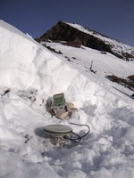 In the framework of the project will be carried out: “Exemplary actions” (e.g. I-F-CH annual rescue meetings, training parks for avalanche transceiver, equipment of bivouacs with emergency transmitters), “Actions of communication” (e.g. Mountain Safety Festival at Breuil Cervinia, Italy, the 20th - 21st August 2016) and “Scientific actions” (e.g. studies on permafrost and related risks, on glacial dynamic and on snow bridges).
The main technical and scientific actions are presented in two short videos highlighting the great efforts made by all partners to realize instrumental installations in high mountain critical contexts in the few months granted by the project.
Summary of the main technical actions carried out by all partners of the "PrévRiskHM" project (July 2016 - April 2017)
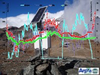
Rocciamelone - Installation of the multiparameter monitoring station of M. Rocciamelone by Arpa Piemonte (October 2016)
NEW !
Communication and training activities for professionals and technicians
Within the "PrèvRiskHauteMontagne" project, great importance has been given to communication and training activities directed to the public and operators of different categories who live and communicate the mountain.
In 2017, the following initiatives were organized:
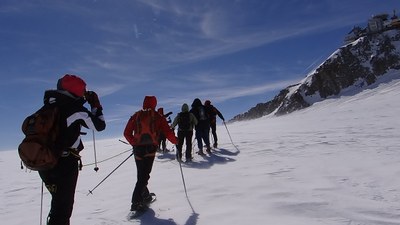
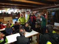
- 9-10 March: High Mountain Seminar - Training course for journalists, where experts on glaciers, permafrost, snow and avalanches and alpine guides met more than 30 information and communication experts. The event took place in the Mont Blanc area between Chamonix (France) and Courmayeur (AO) with indoor ateliers and glacier excursions to reach the high altitude environment.
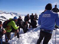
- April 7: Presentation of permafrost monitoring activities and preliminary results at the "III Interconnection Snow Water Equivalent", organized in collaboration with Arpa Valle d'Aosta at the Arpa Piemonte’s monitoring station at the Salati Pass - Corno del Camoscio ( Alagna Valsesia), 3020 m of altitude.
- June-July: training days with accreditation for geologists and engineers enrolled in the respective Professional Boards of Piemonte and Valle d'Aosta, dedicated to permafrost and related issues.
 |
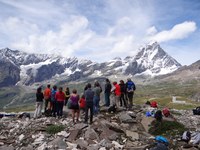 |
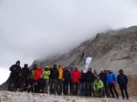
| July 25-27 - Appointments with the Geologists of Piemonte to the permafrost monitoring sites of Arpa Piemonte (left, Colle Sommeiller, Bardonecchia) and Arpa Valle d'Aosta (right, Cervinia) | |
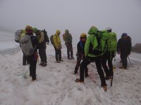
- July 19-20: Glacier training for technicians and mountaineering with mountain guides.
 |
 |
Lithosphere thermal monitoring and thermometer calibration of permafrost monitoring stations in the Piedmont Alps
It is in progress the ordinary / extraordinary maintenance of the permafrost monitoring stations managed by Arpa Piemonte. In addition new installations and technical-scientific activities have been done in order to deepen and implement knowledge about the periglacial environment and permafrost.
- July 12: Survey in the REM Ice Cave (Ligurian Alps) and installation of new thermometers for the monitoring of the effects of climate change within glacial ice caves (activity carried out in collaboration with Prof. Vigna, Politecnico di Torino).
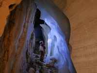 |
| Foto: B. Vigna, PoliTO |
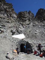
- July 26: installation of new sensors for the thermal monitoring of the first artificial tunnel of the Alps "Buco di Viso" realized by the Marquis of Saluzzo in 1480 ca. and restored by Regione Piemonte in 2014. The tunnel, about 80 m long, develops to approximately 2900 m in height by connecting the Valle Po and Queyras beneath the Traversette Pass (activity carried out in collaboration with Parco Monviso).
|
Thermometer installation inside the
|
 |
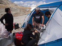
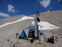
- July 31 - August 2: on-site thermometer calibration of the Colle Sommeiller permafrost monitoring station. The activity carried out in collaboration with INRiM (National Institute of Metrology Research, Turin) in the framework of the MeteoMet2 project "Metrology for Meteorology". To perform the calibration, a mobile laboratory was set up at about 3000 m, near the station, and calibrating 14 thermometers located in deep wells of 10 and 100 m. The thermal thresholds analyzed were: -7, -3, 0, +3, +7 with return at 0 ° C. The results of that work will be available in the coming weeks. At the end of the work there was also a delegation of the Italian Meteorological Society led by Luca Mercalli who has dedicated a news published on the national pages of “La Stampa” on August 4th.
 |
 |
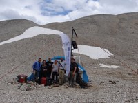 |
On-site laboratory and |
- May 23 - August 22: georadar and UAV detailed photogrammetric surveys of the active rock glacier of Vei del Bouc (Maritimes Alpes). The activity, carried out in collaboration with the University of Pisa and Arpa Valle d'Aosta, continues the studies began last summer on the debris lobe southernmost of the Alps, containing ice and moving downslope.
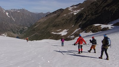 |
| Survey with georadar |
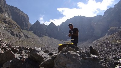 |
| UAV set up for detailed photogrammetric survey |
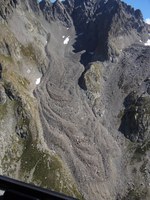 |
| The Vei del Bouc rock glacier (Entracque, CN) |
Main activities 2016 (all links in Italian)
April-May 2016: Project starting and "snow bridges" data collection
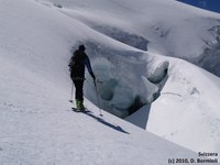
Within the project "PrévRiskHauteMontagne" comes out a cross-border study on accidents at high altitude caused by the rupture of the snow bridges over the glacier.
This study has two main objectives:
1. better understand the structure of the snow bridges and failure mechanisms, through the specific experimental instrumentation installed in a pilot site (in summer 2016);
2. determine the sites more prone to accidents, the causes of accidents and risk management by mountaineers, with the aim of improving preventive actions.
 |
 |
July 2016: News from Piedmont Alps permafrost
Summary of activities on permafrost monitoring in the Piedmont Alps presented on numerous occasions, both locally and internationally, including:
- Regional Environment Report by Arpa Piedmont;
- Presentation at Tempmeko 2016 Zakopane (Poland) relating to metrological aspects and uncertainties in temperature measurements by INRiM (National Institute of Metrological Research) as part of the collaboration in the project MeteoMet2;
- 2015 Annual Review of permafrost activities in the Country Report of the International Permafrost Association;
- publishing article on the geotechnical-thermal monitoring of the M. Rocciamelone (in which a new multiparametric station have been installed within the project “PrévRIskHauteMontagne” in Oct. 2016).
August 2016: Mountain Safety Festival (Cervinia)
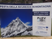
Saturday 20th and Sunday 21st August the "Mountain safety Festival" was held in the beautiful setting of Cervinia (Aosta), organized within the European project ALCOTRA "PrévRiskHauteMontagne". About 7,000 people attended to the "two-days all-mountain" (as it is called by the organizers) animating the thematic stands, amazing to the performances of the Civil Protection, climbing the wall and participating to the educational excursions. Arpa Piemonte fitted out, in collaboration with ARPA Valle d'Aosta and CREALP (CH), the stand of "study and monitoring of the permafrost" with videos, posters, instrumental tests, distribution of publications and explanations to the public.
 |
 |
October 2016: Rocciamelone monitoring station
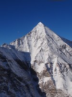
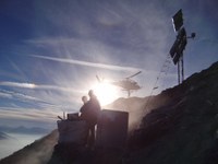
A multi-monitoring station has been installed on the South ridge of M. Rocciamelone, at an altitude of about 3150 m.
The station consists of a probe 30 m long inserted in a vertical well drilled in rock, provided with 30 sensors for measuring every meter temperature and rock deformation; 2 acceleration sensors and 1 piezometric probe to assess the presence of water are presents in the measure column. The station is located near a detachment scarp of a landslide activated in 2006-2007 and complete the surface geotechnical-thermal monitoring carried out by Arpa for about 10 years.
This station represents a major challenge both from a technical and scientific perspective, and from the point of view of the goal: to develop a predictive model of the slope evolution in relation to the dynamics of climate changes, both to analyze the relationships between atmosphere and lithosphere, and to provide an operational tool for the management of natural hazards.
 |
 |
December 2016: Workshop on new technologies for landslide monitoring
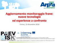
On 15 December, the Dept. Geology and Natural Hazards organized the workshop on "Update on the landslide monitoring: new technologies and sharing experiences", within the framework of the project "PrévRiskHauteMontagne”.
The main objectives of the meeting were 1) to present the landslide monitoring sites with new technologies installed by ARPA Piemonte within the ReRCoMF (regional monitoring network of landslide movement) and 2) to compare different methods of continuous monitoring. The workshop involved colleagues of Arpa Lombardia and Liguria (dealing with landslides and alerting), the Evaluation Group of the Piedmont Region (technical of the territorial structures that deal with planning and public works), the regional Civil Protection, CNR-IRPI of Turin and some manufacturers of innovative tools.
More information:
Permafrost monitoring in Piedmont Alps (in Italian)

